
蔗香镇 topographic map
Interactive map
Click on the map to display elevation.
About this map
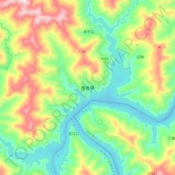
Name: 蔗香镇 topographic map, elevation, terrain.
Location: 蔗香镇, 望谟县, 贵州省, 中国 (24.93009 106.10748 25.01009 106.18748)
Average elevation: 546 m
Minimum elevation: 299 m
Maximum elevation: 959 m
Other topographic maps
Click on a map to view its topography, its elevation and its terrain.