
Hundisburg topographic map
Interactive map
Click on the map to display elevation.
About this map
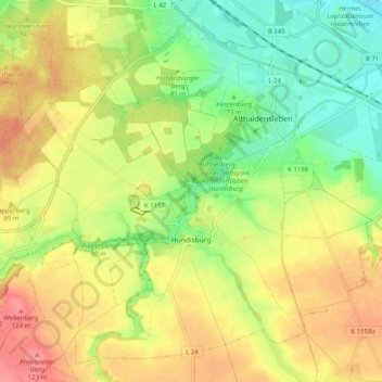
Name: Hundisburg topographic map, elevation, terrain.
Location: Hundisburg, Haldensleben, Börde, Sachsen-Anhalt, Deutschland (52.22680 11.34474 52.28218 11.44542)
Average elevation: 86 m
Minimum elevation: 48 m
Maximum elevation: 126 m
Other topographic maps
Click on a map to view its topography, its elevation and its terrain.
Wahrberg
Deutschland > Sachsen-Anhalt > Haldensleben
Wahrberg, Haldensleben, Börde, Sachsen-Anhalt, 39345, Deutschland
Average elevation: 93 m