
Safsaf topographic map
Interactive map
Click on the map to display elevation.
About this map
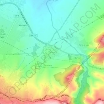
Name: Safsaf topographic map, elevation, terrain.
Location: Safsaf, Chetouane, Daïra Chetouane, Tlemcen, 13048, Algérie (34.87995 -1.29596 34.91995 -1.25596)
Average elevation: 654 m
Minimum elevation: 558 m
Maximum elevation: 843 m
Other topographic maps
Click on a map to view its topography, its elevation and its terrain.
Ouzidane
Algérie > Tlemcen > Daïra Chetouane > Chetouane
Ouzidane, Chetouane, Daïra Chetouane, Tlemcen, 13048, Algérie
Average elevation: 542 m