
Ouzidane topographic map
Interactive map
Click on the map to display elevation.
About this map
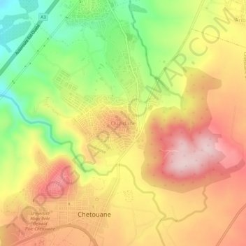
Name: Ouzidane topographic map, elevation, terrain.
Location: Ouzidane, Chetouane, Daïra Chetouane, Tlemcen, 13048, Algérie (34.91558 -1.30531 34.95558 -1.26531)
Average elevation: 542 m
Minimum elevation: 381 m
Maximum elevation: 676 m
Other topographic maps
Click on a map to view its topography, its elevation and its terrain.
Safsaf
Algérie > Tlemcen > Daïra Chetouane > Chetouane
Safsaf, Chetouane, Daïra Chetouane, Tlemcen, 13048, Algérie
Average elevation: 654 m