
阿拉乡 topographic map
Interactive map
Click on the map to display elevation.
About this map
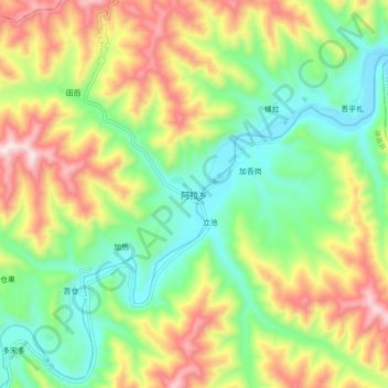
Name: 阿拉乡 topographic map, elevation, terrain.
Location: 阿拉乡, 碌曲县, 甘南藏族自治州, 甘肃省, 中国 (34.58788 102.84689 34.66788 102.92689)
Average elevation: 3,115 m
Minimum elevation: 2,859 m
Maximum elevation: 3,507 m
Other topographic maps
Click on a map to view its topography, its elevation and its terrain.