
尕海镇 topographic map
Interactive map
Click on the map to display elevation.
About this map
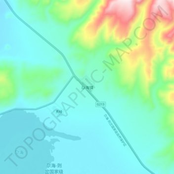
Name: 尕海镇 topographic map, elevation, terrain.
Location: 尕海镇, 碌曲县, 甘南藏族自治州, 甘肃省, 中国 (34.21672 102.32937 34.29672 102.40937)
Average elevation: 3,593 m
Minimum elevation: 3,455 m
Maximum elevation: 4,109 m
Other topographic maps
Click on a map to view its topography, its elevation and its terrain.