
井桶子沟门 topographic map
Interactive map
Click on the map to display elevation.
About this map
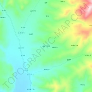
Name: 井桶子沟门 topographic map, elevation, terrain.
Location: 井桶子沟门, 围场满族蒙古族自治县, 承德市, 河北省, 中国 (41.91731 117.89039 41.95731 117.93039)
Average elevation: 995 m
Minimum elevation: 881 m
Maximum elevation: 1,267 m
Other topographic maps
Click on a map to view its topography, its elevation and its terrain.