
婺源县 topographic map
Interactive map
Click on the map to display elevation.
About this map
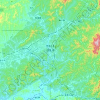
Name: 婺源县 topographic map, elevation, terrain.
Location: 婺源县, 蚺城街道, 婺源县, 上饶市, 江西省, 中国 (29.09066 117.69583 29.41066 118.01583)
Average elevation: 171 m
Minimum elevation: 46 m
Maximum elevation: 866 m
东部、北部为山区,中部、南部多丘陵、盆地。基本地貌特征呈北高南低。最高山峰擂鼓峰,位于北部与休宁交界处,海拔1629米。
Other topographic maps
Click on a map to view its topography, its elevation and its terrain.