
Kentau topographic map
Interactive map
Click on the map to display elevation.
About this map
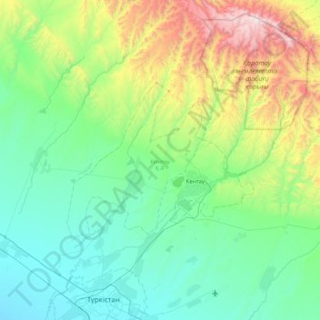
Name: Kentau topographic map, elevation, terrain.
Location: Kentau, Turkistan Region, 160400, Kazakhstan (43.40907 68.17849 43.69823 68.97720)
Average elevation: 607 m
Minimum elevation: 192 m
Maximum elevation: 2,153 m
Other topographic maps
Click on a map to view its topography, its elevation and its terrain.
Atakent
Kazakhstan > Turkistan Region > Maqtaaral District > Ильич кенттік әкімдігі
Average elevation: 263 m