
阳康乡 topographic map
Interactive map
Click on the map to display elevation.
About this map
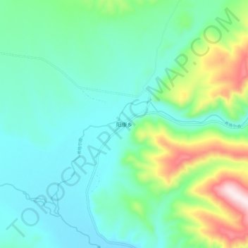
Name: 阳康乡 topographic map, elevation, terrain.
Location: 阳康乡, 天峻县, 海西蒙古族藏族自治州, 青海省, 中国 (37.63762 98.59163 37.71762 98.67163)
Average elevation: 3,750 m
Minimum elevation: 3,620 m
Maximum elevation: 4,171 m
Other topographic maps
Click on a map to view its topography, its elevation and its terrain.