
生格乡 topographic map
Interactive map
Click on the map to display elevation.
About this map
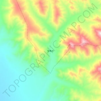
Name: 生格乡 topographic map, elevation, terrain.
Location: 生格乡, 天峻县, 海西蒙古族藏族自治州, 青海省, 中国 (37.23462 98.41795 37.31462 98.49795)
Average elevation: 3,694 m
Minimum elevation: 3,372 m
Maximum elevation: 4,286 m
海拔在3,400–4,200米之间,植被以高寒草甸为主。
Other topographic maps
Click on a map to view its topography, its elevation and its terrain.