
北城区街道 topographic map
Interactive map
Click on the map to display elevation.
About this map
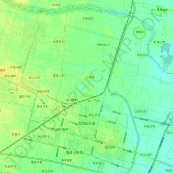
Name: 北城区街道 topographic map, elevation, terrain.
Location: 北城区街道, 定州市, 保定市, 河北省, 中国 (38.49796 114.97661 38.58572 115.05649)
Average elevation: 58 m
Minimum elevation: 49 m
Maximum elevation: 67 m
Other topographic maps
Click on a map to view its topography, its elevation and its terrain.