
新农 topographic map
Interactive map
Click on the map to display elevation.
About this map
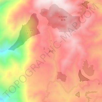
Name: 新农 topographic map, elevation, terrain.
Location: 新农, 会理市, 凉山彝族自治州, 四川省, 中国 (26.19350 101.93138 26.23350 101.97138)
Average elevation: 1,938 m
Minimum elevation: 1,270 m
Maximum elevation: 2,257 m
Other topographic maps
Click on a map to view its topography, its elevation and its terrain.