
Thank you for supporting this site ❤️
Make a donation
Make a donation
Matrouh Governorate topographic map
Click on the map to display elevation.
Thank you for supporting this site ❤️
Make a donation
Make a donation
About this map
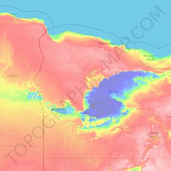
Name: Matrouh Governorate topographic map, elevation, terrain.
Location: Matrouh Governorate, Egypt (27.33878 23.88947 32.53878 29.08947)
Average elevation: 101 m
Minimum elevation: -127 m
Maximum elevation: 345 m
Thank you for supporting this site ❤️
Make a donation
Make a donation
Other topographic maps
Click on a map to view its topography, its elevation and its terrain.