
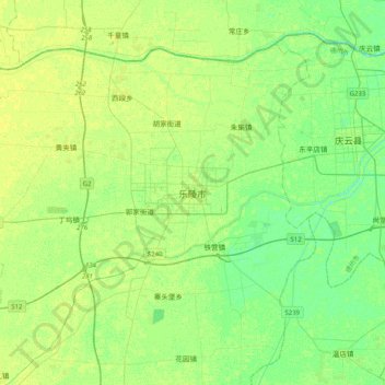
乐陵市 topographic map
Interactive map
Click on the map to display elevation.
About this map
Name: 乐陵市 topographic map, elevation, terrain.
Location: 乐陵市, 德州市, 乐陵市, 山东省, 253600, 中国 (37.56897 117.05357 37.88897 117.37357)
Average elevation: 12 m
Minimum elevation: 5 m
Maximum elevation: 17 m
乐陵地处中国北部华北平原一带,辖区内大多为平原地形,传统农业发达。
Other topographic maps
Click on a map to view its topography, its elevation and its terrain.