
Waters Creek topographic map
Interactive map
Click on the map to display elevation.
About this map
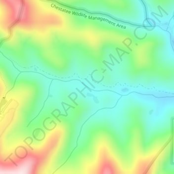
Name: Waters Creek topographic map, elevation, terrain.
Location: Waters Creek, Lumpkin County, Georgia, United States (34.67643 -83.96570 34.67894 -83.95270)
Average elevation: 663 m
Minimum elevation: 532 m
Maximum elevation: 901 m
Other topographic maps
Click on a map to view its topography, its elevation and its terrain.
Dahlonega
United States > Georgia > Lumpkin County
Dahlonega, Lumpkin County, Georgia, United States
Average elevation: 411 m
Burtsboro
United States > Georgia > Lumpkin County > Burtsboro
Burtsboro, Lumpkin County, Georgia, United States
Average elevation: 453 m
Nimblewill
United States > Georgia > Lumpkin County
Nimblewill, Lumpkin County, Georgia, United States
Average elevation: 528 m