
Chiang Mai City Municipality topographic map
Interactive map
Click on the map to display elevation.
Chiang Mai City Municipality
The city is situated in a valley on a river basin in the Thai highlands and is on average at 300 m (1,000 ft) elevation. Chiang Mai's city centre sits west of the Ping River, a tributary to the Chao Phraya River, while the city's sprawl extends north-west, south-west, north-east and east of the river. To the west side of Chiang Mai lies the Thanon Thong Chai Mountain Range, with one major peak, Doi Suthep mountain, prominently rising above the city with an elevation of 1,676 metres (5,499 ft).
About this map
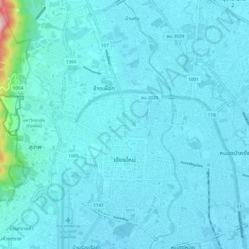
Name: Chiang Mai City Municipality topographic map, elevation, terrain.
Average elevation: 325 m
Minimum elevation: 300 m
Maximum elevation: 668 m
Other topographic maps
Click on a map to view its topography, its elevation and its terrain.
Prachuap Khiri Khan
Thailand > Mueang Prachuap Khiri Khan
Prachuap Khiri Khan covers an area totaling 6,367 square kilometers (2,458 sq mi). The province is on the Kra Isthmus, the narrow land bridge connecting the Malay Peninsula with mainland Asia. The province has one of the narrowest parts of Thailand, just 12.38 km (7.69 mi) from the Gulf of Thailand to the…
Average elevation: 9 m
Ban Bang Sao Thong
Thailand > Bang Sao Thong Subdistrict Administrative Organization > Bang Sao Thong Subdistrict
Average elevation: 4 m
Phu Kradung
Phu Kradueng National Park (Thai: อุทยานแห่งชาติภูกระดึง), in the Si Than sub-district of Amphoe Phu Kradueng, Loei Province, is a national park in Thailand. It has a high point of 1,316 m (4318 ft) elevation at Khok Moei. It was proclaimed a national park on 23…
Average elevation: 1,183 m
Ban Khlong Lat Krabang
Thailand > Racha Thewa Subdistrict Administrative Organization > Racha Thewa Subdistrict
Average elevation: 4 m