
Thank you for supporting this site ❤️
Make a donation
Make a donation
Maejo topographic map
Click on the map to display elevation.
Thank you for supporting this site ❤️
Make a donation
Make a donation
About this map
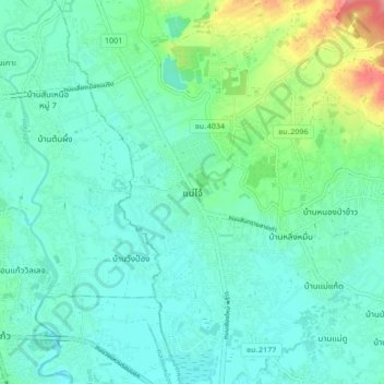
Name: Maejo topographic map, elevation, terrain.
Location: Maejo, Pa Phai, San Sai, Chiang Mai Province, 50290, Thailand (18.85708 98.96813 18.93708 99.04813)
Average elevation: 322 m
Minimum elevation: 303 m
Maximum elevation: 390 m
Thank you for supporting this site ❤️
Make a donation
Make a donation