
Gomzé-Andoumont topographic map
Interactive map
Click on the map to display elevation.
About this map
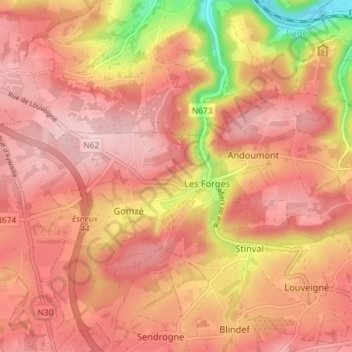
Name: Gomzé-Andoumont topographic map, elevation, terrain.
Location: Gomzé-Andoumont, Sprimont, Liège, Wallonie, 4140, Belgique (50.53432 5.64699 50.55581 5.71930)
Average elevation: 238 m
Minimum elevation: 94 m
Maximum elevation: 301 m
Other topographic maps
Click on a map to view its topography, its elevation and its terrain.
Dolembreux
Belgique > Liège > Liège > Sprimont
Dolembreux, Sprimont, Liège, Wallonie, 4140, Belgique
Average elevation: 233 m