Geolocate

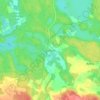
Miastko topographic map

Click on the map to display elevation.

About this map

Name: Miastko topographic map, elevation, terrain.

Location: Miastko, gmina Miastko, Bytów County, Pomeranian Voivodeship, 77-200, Poland (53.98871 16.94710 54.01984 16.99551)

Average elevation: 140 m

Minimum elevation: 105 m

Maximum elevation: 177 m

Other topographic maps

Click on a map to view its topography, its elevation and its terrain.

Suchorze

Poland > Pomeranian Voivodeship > Bytów County

Average elevation: 128 m

Klewiska

Poland > Pomeranian Voivodeship > Bytów County > Skryte

Average elevation: 162 m

Sierzno

Poland > Pomeranian Voivodeship > Bytów County

Average elevation: 165 m

Soszyca

Poland > Pomeranian Voivodeship > Bytów County

Average elevation: 128 m

Nożynko

Poland > Pomeranian Voivodeship > Bytów County

Average elevation: 112 m

Sierzno

Poland > Pomeranian Voivodeship > Bytów County

Average elevation: 165 m