
Pandamaran Jaya topographic map
Interactive map
Click on the map to display elevation.
About this map
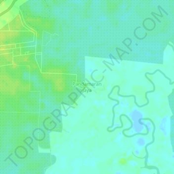
Name: Pandamaran Jaya topographic map, elevation, terrain.
Location: Pandamaran Jaya, Tanah Bumbu, South Kalimantan, Indonesia (-3.77778 115.49000 -3.73778 115.53000)
Average elevation: 6 m
Minimum elevation: -2 m
Maximum elevation: 15 m
Other topographic maps
Click on a map to view its topography, its elevation and its terrain.
Mekar Jaya
Indonesia > South Kalimantan > Tanah Bumbu > Mekar Jaya
Mekar Jaya, Tanah Bumbu, South Kalimantan, Indonesia
Average elevation: 13 m
Sungai Dua
Indonesia > South Kalimantan > Tanah Bumbu
Sungai Dua, Tanah Bumbu, South Kalimantan, Indonesia
Average elevation: 7 m