
Mekar Jaya topographic map
Interactive map
Click on the map to display elevation.
About this map
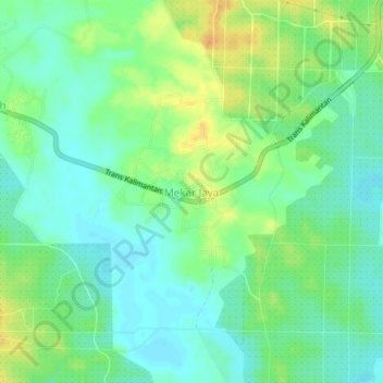
Name: Mekar Jaya topographic map, elevation, terrain.
Location: Mekar Jaya, Tanah Bumbu, South Kalimantan, Indonesia (-3.74329 115.60878 -3.70329 115.64878)
Average elevation: 13 m
Minimum elevation: 1 m
Maximum elevation: 32 m