
洞庭湖 topographic map
Interactive map
Click on the map to display elevation.
About this map
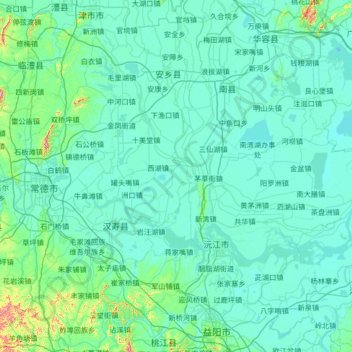
Name: 洞庭湖 topographic map, elevation, terrain.
Location: 洞庭湖, 湘阴县, 岳阳市, 湖南省, 中国 (28.62695 111.80291 29.51522 113.14289)
Average elevation: 49 m
Minimum elevation: 18 m
Maximum elevation: 535 m
Other topographic maps
Click on a map to view its topography, its elevation and its terrain.