
Pumori topographic map
Interactive map
Click on the map to display elevation.
About this map
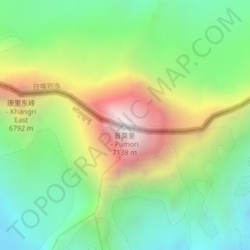
Name: Pumori topographic map, elevation, terrain.
Location: Pumori, 扎西宗, 定日县, 日喀则市, 西藏自治区, 中国 (28.01599 86.82735 28.01609 86.82745)
Average elevation: 6,065 m
Minimum elevation: 5,396 m
Maximum elevation: 7,157 m
Other topographic maps
Click on a map to view its topography, its elevation and its terrain.