
结古街道 topographic map
Interactive map
Click on the map to display elevation.
About this map
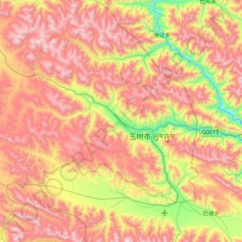
Name: 结古街道 topographic map, elevation, terrain.
Location: 结古街道, 玉树市, 玉树藏族自治州, 青海省, 中国 (32.85725 96.66901 33.18898 97.25831)
Average elevation: 4,386 m
Minimum elevation: 3,531 m
Maximum elevation: 5,225 m
Other topographic maps
Click on a map to view its topography, its elevation and its terrain.