
小苏莽乡 topographic map
Interactive map
Click on the map to display elevation.
About this map
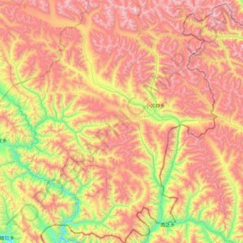
Name: 小苏莽乡 topographic map, elevation, terrain.
Location: 小苏莽乡, 玉树市, 玉树藏族自治州, 青海省, 中国 (32.02753 96.85771 32.59669 97.42394)
Average elevation: 4,421 m
Minimum elevation: 3,517 m
Maximum elevation: 5,361 m
Other topographic maps
Click on a map to view its topography, its elevation and its terrain.