
南靖县 topographic map
Interactive map
Click on the map to display elevation.
About this map
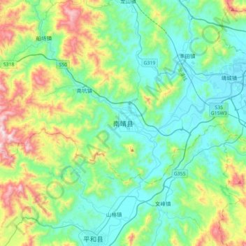
Name: 南靖县 topographic map, elevation, terrain.
Location: 南靖县, 漳州市, 福建省, 中国 (24.35678 117.19239 24.67678 117.51239)
Average elevation: 262 m
Minimum elevation: 6 m
Maximum elevation: 1,043 m
Other topographic maps
Click on a map to view its topography, its elevation and its terrain.