
Thank you for supporting this site ❤️
Make a donation
Make a donation
Ashdod topographic map
Click on the map to display elevation.
Thank you for supporting this site ❤️
Make a donation
Make a donation
About this map
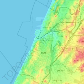
Name: Ashdod topographic map, elevation, terrain.
Location: Ashdod, Ashkelon Subdistrict, South District, Israel (31.75316 34.60880 31.87282 34.71026)
Average elevation: 17 m
Minimum elevation: -1 m
Maximum elevation: 64 m
Thank you for supporting this site ❤️
Make a donation
Make a donation
Other topographic maps
Click on a map to view its topography, its elevation and its terrain.