Geolocate

昌乐县 topographic map

Interactive map

Click on the map to display elevation.

About this map

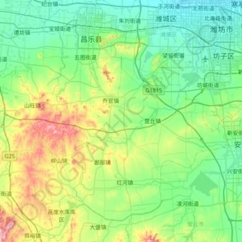
Name: 昌乐县 topographic map, elevation, terrain.

Location: 昌乐县, 潍坊市, 山东省, 262400, 中国 (36.28618 118.71376 36.76297 119.17351)

Average elevation: 119 m

Minimum elevation: 19 m

Maximum elevation: 470 m

Other topographic maps

Click on a map to view its topography, its elevation and its terrain.

西董

中国 > 山东省 > 潍坊市

西董, 潍坊市, 山东省, 261311, 中国

Average elevation: 7 m

吴家营

中国 > 山东省 > 潍坊市

吴家营, 潍坊市, 山东省, 中国

Average elevation: 55 m

长埠

中国 > 山东省 > 潍坊市

长埠, 潍坊市, 山东省, 261306, 中国

Average elevation: 7 m

潍坊市

中国 > 山东省 > 潍坊市

潍坊市, 奎文区, 潍坊市, 山东省, 261042, 中国

Average elevation: 42 m

玉皇顶

中国 > 山东省 > 潍坊市

玉皇顶, 潍坊市, 山东省, 中国

Average elevation: 783 m

瓦西

中国 > 山东省 > 潍坊市 > 瓦西

瓦西, 潍坊市, 山东省, 中国

Average elevation: 5 m