
宾达乡 topographic map
Interactive map
Click on the map to display elevation.
About this map
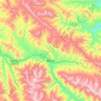
Name: 宾达乡 topographic map, elevation, terrain.
Location: 宾达乡, 类乌齐县, 昌都市, 西藏自治区, 中国 (31.02276 96.67390 31.25566 96.95778)
Average elevation: 4,367 m
Minimum elevation: 3,451 m
Maximum elevation: 5,336 m
Other topographic maps
Click on a map to view its topography, its elevation and its terrain.