
保华乡 topographic map
Interactive map
Click on the map to display elevation.
About this map
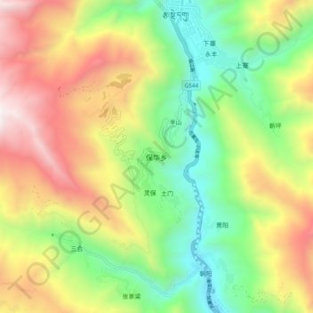
Name: 保华乡 topographic map, elevation, terrain.
Location: 保华乡, 九寨沟县, 阿坝藏族羌族自治州, 四川省, 623400, 中国 (33.17407 104.19533 33.25407 104.27533)
Average elevation: 2,083 m
Minimum elevation: 1,278 m
Maximum elevation: 3,180 m
Other topographic maps
Click on a map to view its topography, its elevation and its terrain.