
福田河镇 topographic map
Interactive map
Click on the map to display elevation.
About this map
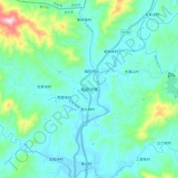
Name: 福田河镇 topographic map, elevation, terrain.
Location: 福田河镇, 黄冈市, 湖北省, 中国 (31.43402 115.05442 31.51402 115.13442)
Average elevation: 176 m
Minimum elevation: 89 m
Maximum elevation: 555 m
Other topographic maps
Click on a map to view its topography, its elevation and its terrain.