
下亚东乡 topographic map
Interactive map
Click on the map to display elevation.
About this map
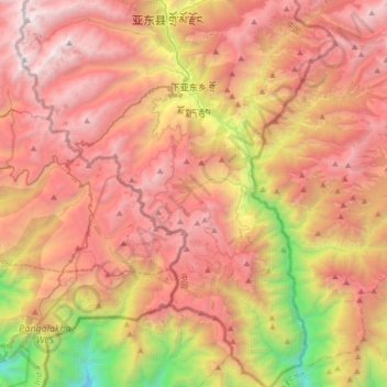
Name: 下亚东乡 topographic map, elevation, terrain.
Location: 下亚东乡, 亚东县, 日喀则市, 西藏自治区, 中国 (27.21205 88.79146 27.50281 89.04715)
Average elevation: 3,583 m
Minimum elevation: 1,505 m
Maximum elevation: 5,206 m
Other topographic maps
Click on a map to view its topography, its elevation and its terrain.