
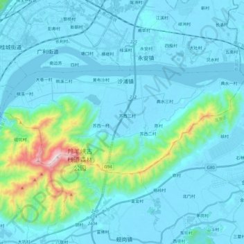
沙浦镇 topographic map
Interactive map
Click on the map to display elevation.
About this map
Name: 沙浦镇 topographic map, elevation, terrain.
Location: 沙浦镇, 鼎湖区, 肇庆市, 广东省, 中国 (23.09315 112.57502 23.17133 112.77497)
Average elevation: 97 m
Minimum elevation: -7 m
Maximum elevation: 874 m
Other topographic maps
Click on a map to view its topography, its elevation and its terrain.