
鼎湖山国家级自然保护区 topographic map
Interactive map
Click on the map to display elevation.
About this map
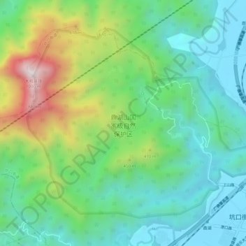
Name: 鼎湖山国家级自然保护区 topographic map, elevation, terrain.
Location: 鼎湖山国家级自然保护区, 鼎湖区, 肇庆市, 广东省, 中国 (23.15602 112.51108 23.19124 112.56067)
Average elevation: 284 m
Minimum elevation: 5 m
Maximum elevation: 947 m
Other topographic maps
Click on a map to view its topography, its elevation and its terrain.