
湾水镇 topographic map
Interactive map
Click on the map to display elevation.
About this map
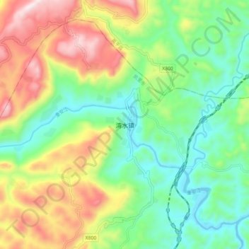
Name: 湾水镇 topographic map, elevation, terrain.
Location: 湾水镇, 凯里市, 黔东南苗族侗族自治州, 贵州省, 中国 (26.69970 107.94200 26.77970 108.02200)
Average elevation: 784 m
Minimum elevation: 546 m
Maximum elevation: 1,183 m
Other topographic maps
Click on a map to view its topography, its elevation and its terrain.