
村 topographic map
Interactive map
Click on the map to display elevation.
About this map
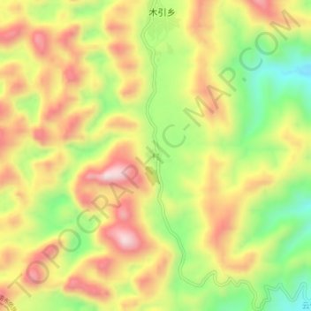
Name: 村 topographic map, elevation, terrain.
Location: 村, 罗甸县, 黔南布依族苗族自治州, 贵州省, 558000, 中国 (25.45440 106.41604 25.49440 106.45604)
Average elevation: 824 m
Minimum elevation: 573 m
Maximum elevation: 1,058 m
Other topographic maps
Click on a map to view its topography, its elevation and its terrain.