
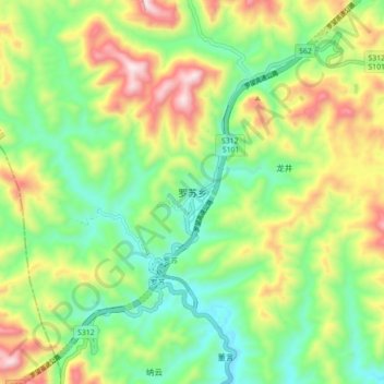
罗苏乡 topographic map
Interactive map
Click on the map to display elevation.
About this map
Name: 罗苏乡 topographic map, elevation, terrain.
Location: 罗苏乡, 罗甸县, 黔南布依族苗族自治州, 贵州省, 558000, 中国 (25.24568 106.48287 25.32568 106.56287)
Average elevation: 723 m
Minimum elevation: 469 m
Maximum elevation: 1,141 m
Other topographic maps
Click on a map to view its topography, its elevation and its terrain.