
Bush topographic map
Interactive map
Click on the map to display elevation.
About this map
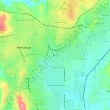
Name: Bush topographic map, elevation, terrain.
Average elevation: 170 m
Minimum elevation: 134 m
Maximum elevation: 240 m
Other topographic maps
Click on a map to view its topography, its elevation and its terrain.
Virginia
United States > Alabama > Jefferson County > Hueytown
Virginia, Hueytown, Jefferson County, Alabama, United States
Average elevation: 146 m