
Caneças topographic map
Interactive map
Click on the map to display elevation.
About this map
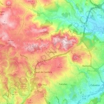
Name: Caneças topographic map, elevation, terrain.
Location: Caneças, Odivelas, Lisboa, 1685-897, Portugal (38.77598 -9.26195 38.85598 -9.18195)
Average elevation: 182 m
Minimum elevation: 9 m
Maximum elevation: 354 m
Other topographic maps
Click on a map to view its topography, its elevation and its terrain.
Casal do Chapim
Casal do Chapim, Odivelas, Lisboa, 2675-595, Portugal
Average elevation: 105 m