
Thank you for supporting this site ❤️
Make a donation
Make a donation
Casal do Chapim topographic map
Click on the map to display elevation.
Thank you for supporting this site ❤️
Make a donation
Make a donation
About this map
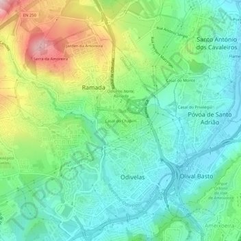
Name: Casal do Chapim topographic map, elevation, terrain.
Location: Casal do Chapim, Odivelas, Lisboa, 2675-589, Portugal (38.77973 -9.20181 38.81973 -9.16181)
Average elevation: 105 m
Minimum elevation: 8 m
Maximum elevation: 325 m
Thank you for supporting this site ❤️
Make a donation
Make a donation
Other topographic maps
Click on a map to view its topography, its elevation and its terrain.