
Spalbeek topographic map
Interactive map
Click on the map to display elevation.
About this map
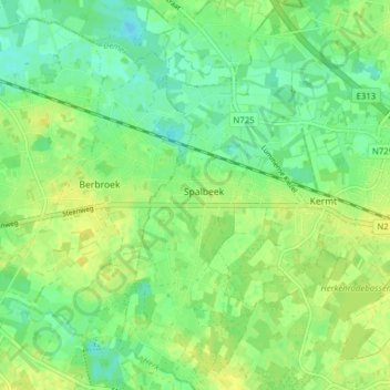
Name: Spalbeek topographic map, elevation, terrain.
Location: Spalbeek, Hasselt, Limburg, Vlaanderen, België (50.92443 5.21215 50.97346 5.24914)
Average elevation: 27 m
Minimum elevation: 17 m
Maximum elevation: 36 m
Other topographic maps
Click on a map to view its topography, its elevation and its terrain.
Sterrebeek
België > Vlaanderen > Hasselt
Sterrebeek, Hasselt, Limburg, Vlaanderen, 3512, België
Average elevation: 32 m
Heksenberg
België > Vlaanderen > Hasselt > Heksenberg
Heksenberg, Hasselt, Limburg, Vlaanderen, 35000, België
Average elevation: 35 m