
Muria topographic map
Interactive map
Click on the map to display elevation.
About this map
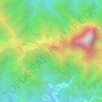
Name: Muria topographic map, elevation, terrain.
Location: Muria, Kudus, Central Java, Indonesia (-6.62005 110.87995 -6.61995 110.88005)
Average elevation: 1,035 m
Minimum elevation: 678 m
Maximum elevation: 1,579 m
Other topographic maps
Click on a map to view its topography, its elevation and its terrain.
Ngemplak
Indonesia > Central Java > Kudus > Ngemplak
Ngemplak, Kudus, Central Java, Indonesia
Average elevation: 8 m