
塔川 topographic map
Interactive map
Click on the map to display elevation.
About this map
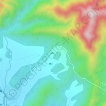
Name: 塔川 topographic map, elevation, terrain.
Location: 塔川, 宏村镇, 黟县, 黄山市, 安徽省, 中国 (30.00015 117.98300 30.04015 118.02300)
Average elevation: 489 m
Minimum elevation: 290 m
Maximum elevation: 1,002 m
Other topographic maps
Click on a map to view its topography, its elevation and its terrain.