
江镜镇 topographic map
Interactive map
Click on the map to display elevation.
About this map
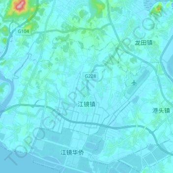
Name: 江镜镇 topographic map, elevation, terrain.
Location: 江镜镇, 福清市, 福州市, 福建省, 中国 (25.52505 119.32508 25.61467 119.45447)
Average elevation: 14 m
Minimum elevation: -2 m
Maximum elevation: 259 m
Other topographic maps
Click on a map to view its topography, its elevation and its terrain.