
黄平县 topographic map
Interactive map
Click on the map to display elevation.
About this map
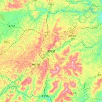
Name: 黄平县 topographic map, elevation, terrain.
Location: 黄平县, 黔东南苗族侗族自治州, 贵州省, 中国 (26.75349 107.75080 27.07349 108.07080)
Average elevation: 853 m
Minimum elevation: 534 m
Maximum elevation: 1,342 m
Other topographic maps
Click on a map to view its topography, its elevation and its terrain.