
内丘县 topographic map
Interactive map
Click on the map to display elevation.
About this map
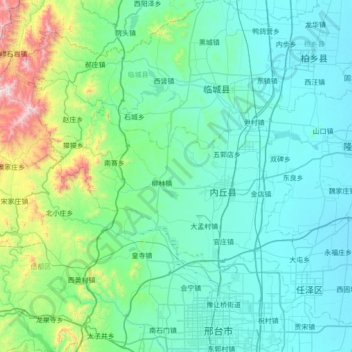
Name: 内丘县 topographic map, elevation, terrain.
Location: 内丘县, 邢台市, 河北省, 054000, 中国 (37.15923 113.94694 37.44838 114.64428)
Average elevation: 224 m
Minimum elevation: 29 m
Maximum elevation: 1,468 m
Other topographic maps
Click on a map to view its topography, its elevation and its terrain.