
Thank you for supporting this site ❤️
Make a donation
Make a donation
Nambikolly topographic map
Click on the map to display elevation.
Thank you for supporting this site ❤️
Make a donation
Make a donation
About this map
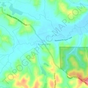
Name: Nambikolly topographic map, elevation, terrain.
Location: Nambikolly, Sulthanbathery, Wayanad, Kerala, 673595, India (11.61597 76.28690 11.65597 76.32690)
Average elevation: 873 m
Minimum elevation: 848 m
Maximum elevation: 939 m
Thank you for supporting this site ❤️
Make a donation
Make a donation
Other topographic maps
Click on a map to view its topography, its elevation and its terrain.