
阿万仓镇 topographic map
Interactive map
Click on the map to display elevation.
About this map
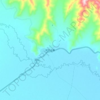
Name: 阿万仓镇 topographic map, elevation, terrain.
Location: 阿万仓镇, 玛曲县, 甘南藏族自治州, 甘肃省, 中国 (33.73093 101.65717 33.81093 101.73717)
Average elevation: 3,548 m
Minimum elevation: 3,494 m
Maximum elevation: 3,929 m
Other topographic maps
Click on a map to view its topography, its elevation and its terrain.