
上清镇 topographic map
Interactive map
Click on the map to display elevation.
About this map
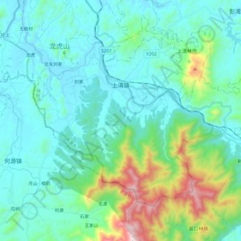
Name: 上清镇 topographic map, elevation, terrain.
Location: 上清镇, 龙虎山区, 贵溪市, 鹰潭市, 江西省, 中国 (27.96410 116.96763 28.07988 117.15091)
Average elevation: 260 m
Minimum elevation: 57 m
Maximum elevation: 1,171 m
Other topographic maps
Click on a map to view its topography, its elevation and its terrain.